

Stormy Weather Tonight Around Tuscaloosa, Cooler Tomorrow
We're in for a wet forecast across Tuscaloosa and West Alabama tonight through Thursday morning, and turning cooler after that. What about the risk for severe weather?
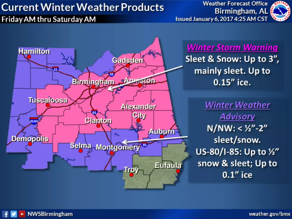
The highest chance of severe weather will stay in the southern part of the state through the night. The National Weather Service in Birmingham has drawn a line from Demopolis to Clanton. Counties south of this line have a limited threat for severe storm or brief tornadoes to spin up. That leaves areas north of the line with next to no severe weather to worry about. Still, heavy rain is possible and so are gusty winds.
Here's the official statement from the NWS:
THERE IS A LOW CONFIDENCE AND LOW-END THREAT FOR SEVERE STORMS
OVERNIGHT ACROSS THE SOUTHERN PARTS OF THE AREA. BRIEF TORNADOES AND DAMAGING WINDS ARE POSSIBLE ALONG AND SOUTHEAST OF A LINE FROM DEMOPOLIS...TO CLANTON...TO ALEXANDER CITY...TO WEDOWEE.
After the storms push through the area, it will be quite a bit cooler with the high only in the 50s. The lows will be in the 30s over the next few nights.
Let's take a look at the forecast maps through tomorrow morning, below.
More From Tide 100.9


![Wind Advisory in Effect Until 12 AM Tuesday, November 29, 2016 [UPDATED]](http://townsquare.media/site/530/files/2016/11/RS9956_176991118-scr.jpg?w=980&q=75)